|
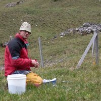
Unmanned Aerial Systems (UAS or drones) give us the unique opportunity to map and monitor vegetation at ultra-high resolution on demand. Furthermore, UAS-based remote sensing will enable us to bridge the scale gap between field-based observations and satellite-based observations. I am responsible for all technical aspects of our drones and the sensors they carry as well as for flying the drones. Furthermore, I am involved in both the image- and field-based research, which aims at understanding vegetation dynamics in arctic ecosystems. Thus, my current field of research is “drone ecology” (the use of drones to answer ecological questions) and I spend most of my summers in remote areas of Greenland to collect ground-based ecological data and to map the tundra vegetation with a drone equipped with different sensors. |
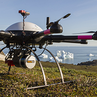 Our octocopter with LiDAR & multispectral sensor, Disko Island, west Greenland Our octocopter with LiDAR & multispectral sensor, Disko Island, west Greenland |
Urs Treier |
Current Research · Publications · Bio |
| Research Scientist, Lab Manager | |
|
|
I am an evolutionary ecologist interested in factors and evolutionary processes that determine the abundance and structure of plant populations. |
Ny Munkegade 116, Building 1540 DK-8000, Aarhus C, Denmark
|
 |
38. The Microflora Danica atlas of Danish environmental microbiomes Singleton CM, Jensen TBN, Delogu F et al. |
Read Abstract |
||
|
Over the past 20 years, there have been considerable advances in revealing the microbiomes that underpin processes in natural and human-associated environments. Recent large-scale metagenome surveys have recorded the variety of microbial life in the oceans, in the human gut and on Earth, with compilations encompassing thousands of public datasets. However, despite their broad scope, these studies often lack functional information, and their sample locations are frequently sparsely distributed, limited in resolution or lacking metadata. Here we present Microflora Danica—an atlas of Danish environmental microbiomes encompassing 10,683 shotgun metagenomes and 450 nearly full-length 16S and 18S rRNA datasets, linked to a five-level habitat classification scheme. We show that although human-disturbed habitats have high alpha diversity, species reoccur, revealing hidden homogeneity. This underlines the role of natural systems in maintaining total species (gamma) diversity and emphasizes the need for national baselines for tracking microbial responses to land-use and climate change. Consequently, we focused our dataset exploration on nitrifiers, a functional group closely linked to climate change and of major importance for Denmark’s primary land use: agriculture. We identify several lineages encoding nitrifier key genes and reveal the effects of land disturbance on the abundance of well-studied, as well as uncharacterized, nitrifier groups, with potential implications for N2O emissions. Microflora Danica offers an unparalleled resource for addressing fundamental questions in microbial ecology about what drives microbial diversity, distribution and function.
|
||||
 |
37. An east–west distribution of genetic diversity in Nordic populations of caraway (Carum carvi L.) and its consequences for conservation prioritisation de Haro Reyes B, Palmé A, Fitzgerald H, Göransson M, Lyytikäinen V, Madsen B, Normand S, Thorbjörnsson H, Treier UA & Hagenblad J |
Read Abstract |
||
|
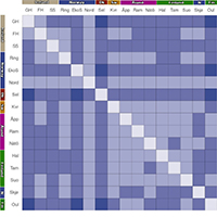
The current global crisis of biodiversity loss calls for urgent conservation actions for many species, not the least wild species related to crop plants. These crop wild relatives are considered harbouring genetic diversity of major importance for future crop plant improvement, e.g. adaptation to climate change. Hence, their conservation needs to be a priority. To ensure the long-term conservation and to maximize the utility value of these species, it is important that as much of their genetic diversity as possible is conserved. Thus, the distribution of intraspecific diversity must be taken into consideration when planning conservation efforts. Caraway, Carum carvi L., has been cultivated since medieval times and is today one of the most important spice crops worldwide. In order to identify populations that would be of particular interest for in situ and ex situ conservation and for use in plant breeding we evaluated the geographic distribution of intraspecific diversity in populations of Carum carvi in the Nordic region (Iceland, Denmark, Norway, Sweden and Finland). Using a genotyping by sequencing approach, we genotyped 198 individuals from 16 Nordic populations. The amount of intrapopulation genetic diversity was similar among populations (mean He = 0.29), and the diversity was structured in an east–westerly manner, probably reflecting colonisation patterns associated with different glacial refugia. In addition, some populations likely have a history shaped by human interventions. The results have important conservation implications and based on the outcome of this study, populations of conservation priority are suggested.
|
||||
 |
36. Temperate forests of high conservation value are successfully identified by satellite and LiDAR data fusion Assmann JJ, Pedersen PBM, Moeslund JE, Senf C, Treier UA, Corcoran D, Koma Z, Nord-Larsen T & Normand S |
Read Abstract |
||
|
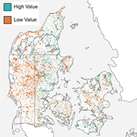
Forest ecosystems will play a critical role in achieving policy targets for biodiversity and conservation, such as those set out in the EU Biodiversity strategy for 2030. However, practitioners need to know where forests of high conservation value are to make the best-informed decisions about which forests to prioritize. Here, we combine airborne LiDAR (airborne laser scanning/ALS), optical satellite imagery, and gridded datasets on soil and water availability with machine learning models to predict forests' conservation value across Denmark. We then use change-detection algorithms to identify forests that had been disturbed since the collection of the LiDAR data to produce up-to-date estimates for the year 2020. Our models reached a high predictive capacity (82% accuracy) and suggested that 1982 km2 (~31%) of Denmark's forests were of potential high conservation value. Our study demonstrates the utility of data fusion approaches to identify forest areas of high value for conservation at fine spatial resolutions (~10–100 m) and nationwide extents. However, uncertainties remain in our approach. Hence, our findings should be used to guide field-based assessments to confirm the in situ conservation value of the forests. Only in combination with such in situ data will approaches like ours enable decision makers to better protect forest biodiversity.
|
||||
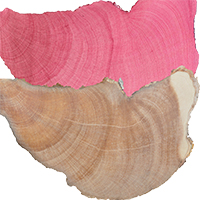 |
35. Common juniper, the oldest nonclonal woody species across the tundra biome and the European continent Carrer M, Dibona R, Frigo D, Gorlanova L, Hantemirov R, Unterholzner L, Normand S, Treier UA & Prendin AL |
Read Abstract |
||
|
Common juniper consistently appears as one of the oldest nonclonal woody plant within tundra vegetation assemblages. We encountered numerous individuals older than 300 years, with some exceeding 500 years. Notably, at two sites in northern Fennoscandia, several common junipers surpassed a thousand years in age, with the oldest being 1647 years old. The northward advance of forest vegetation can rapidly outcompete old junipers and alter the natural disturbance regime that commonly shapes tundra assemblages. This emphasizes the need to first recognize and then implement conservation efforts to prevent the loss of this unique component of the tundra biome.
|
||||
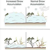 |
34. No effect of snow on shrub xylem traits: Insights from a snow-manipulation experiment on Disko Island, Greenland Power CC, Normand S, von Arx G, Elberling B, Corcoran C, Krog AB, Bouvin NK, Treier UA, Westergaard-Nielsen A, Liu Y & Prendin AL |
Read Abstract |
||
|
Widespread shrubification across the Arctic has been generally attributed to increasing air temperatures, but responses vary across species and sites. Wood structures related to the plant hydraulic architecture may respond to local environmental conditions and potentially impact shrub growth, but these relationships remain understudied. Using methods of dendroanatomy, we analysed shrub ring width (RW) and xylem anatomical traits of 80 individuals of Salix glauca L. and Betula nana L. at a snow manipulation experiment in Western Greenland. We assessed how their responses differed between treatments (increased versus ambient snow depth) and soil moisture regimes (wet and dry). Despite an increase in snow depth due to snow fences (28–39 %), neither RW nor anatomical traits in either species showed significant responses to this increase. In contrast, irrespective of the snow treatment, the xylem specific hydraulic conductivity (Ks) and earlywood vessel size (LA95) for the study period were larger in S. glauca (p < 0.1, p < 0.01) and B. nana (p < 0.01, p < 0.001) at the wet than the dry site, while both species had larger vessel groups at the dry than the wet site (p < 0.01). RW of B. nana was higher at the wet site (p < 0.01), but no differences were observed for S. glauca. Additionally, B. nana Ks and LA95 showed different trends over the study period, with decreases observed at the dry site (p < 0.001), while for other responses no difference was observed. Our results indicate that, taking into account ontogenetic and allometric trends, hydraulic related xylem traits of both species, along with B. nana growth, were influenced by soil moisture. These findings suggest that soil moisture regime, but not snow cover, may determine xylem responses to future climate change and thus add to the heterogeneity of Arctic shrub dynamics, though more long-term species- and site- specific studies are needed.
|
||||
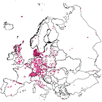 |
33. ReSurveyEurope: A database of resurveyed vegetation plots in Europe Knollová I, Chytrý M, Bruelheide H, Dullinger S et al. |
Read Abstract |
||
|
Aims
|
||||
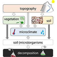 |
32. Microclimate explains little variation in year-round decomposition across an Arctic tundra landscape von Oppen J, Assmann JJ, Bjorkman AD, Treier UA, Elberling B & Normand S |
Read Abstract |
||
|
Litter decomposition represents a major path for atmospheric carbon influx into Arctic soils, thereby controlling below-ground carbon accumulation. Yet, little is known about how tundra litter decomposition varies with microenvironmental conditions, hindering accurate projections of tundra soil carbon dynamics with future climate change. Over 14 months, we measured landscape-scale decomposition of two contrasting standard litter types (Green tea and Rooibos tea) in 90 plots covering gradients of micro-climate and -topography, vegetation cover and traits, and soil characteristics in Western Greenland. We used the tea bag index (TBI) protocol to estimate relative variation in litter mass loss, decomposition rate (k) and stabilisation factor (S) across space, and structural equation modelling (SEM) to identify relationships among environmental factors and decomposition. Contrasting our expectations, microenvironmental factors explained little of the observed variation in both litter mass loss, as well as k and S, suggesting that the variables included in our study were not the major controls of decomposer activity in the soil across the studied tundra landscape. We use these unexpected findings of our study combined with findings from the current literature to discuss future avenues for improving our understanding of the drivers of tundra decomposition and, ultimately, carbon cycling across the warming Arctic.
Keywords: Arctic tundra • carbon cycling • litter decomposition • microclimate • soil moisture • soil temperature • stratified random sampling • structural equation modelling (SEM) • tea bag index (TBI) |
||||
 |
31. Mapping intertidal macrophytes in fjords in Southwest Greenland using Sentinel-2 imagery Carlson DF, Vivó-Pons A, Treier UA, Mätzler E, Meire L, Sejr M & Krause-Jensen D |
Read Abstract |
||
|
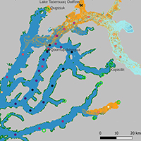
Changes in the distribution of coastal macrophytes in Greenland, and elsewhere in the Arctic are difficult to quantify as the region remains challenging to access and monitor. Satellite imagery, in particular Sentinel-2 (S2), may enable large-scale monitoring of coastal areas in Greenland but its use is impacted by the optically complex environments and the scarcity of supporting data in the region. Additionally, the canopies of the dominant macrophyte species in Greenland do not extend to the sea surface, limiting the use of indices that exploit the reflection of near-infrared radiation by vegetation due to its absorption by seawater. Three hypotheses are tested: I) 10-m S2 imagery and commonly used detection methods can identify intertidal macrophytes that are exposed at low tide in an optically complex fjord system in Greenland impacted by marine and land terminating glaciers; II) detached and floating macrophytes accumulate in patches that are sufficiently large to be detected by 10-m S2 images; III) iceberg scour and/or turbid meltwater runoff shape the spatial distribution of intertidal macroalgae in fjord systems with marine-terminating glaciers. The NDVI produced the best results in optically complex fjord systems in Greenland. 12 km2 of exposed intertidal macrophytes were identified in the study area at low tide. Floating mats of macrophytes ranged in area from 400 m2 to 326,800 m2 and were most common at the mouth of the fjord. Icebergs and turbidity appear to play a role in structuring the distribution of intertidal macrophytes and the retreat of marine terminating glaciers could allow macrophytes cover to expand. The challenges and solutions presented here apply to most fjords in Greenland and, therefore, the methodology may be extended to produce a Greenland-wide estimate of intertidal macrophytes.
|
||||
 |
30. Cross-scale regulation of seasonal microclimate by vegetation and snow in the Arctic tundra von Oppen J, Assmann JJ, Bjorkman AD, Treier UA, Elberling B, Nabe-Nielsen J & Normand S |
Read Abstract |
||
|
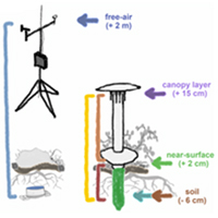
Climate warming is inducing widespread vegetation changes in Arctic tundra ecosystems, with the potential to alter carbon and nutrient dynamics between vegetation and soils. Yet, we lack a detailed understanding of how variation in vegetation and topography influences fine-scale temperatures (“microclimate”) that mediate these dynamics, and at what resolution vegetation needs to be sampled to capture these effects. We monitored microclimate at 90 plots across a tundra landscape in western Greenland. Our stratified random study design covered gradients of topography and vegetation, while nested plots (0.8–100 m2) enabled comparison across different sampling resolutions. We used Bayesian mixed-effect models to quantify the direct influence of plot-level topography, moisture and vegetation on soil, near-surface and canopy-level temperatures (−6, 2, and 15 cm). During the growing season, colder soils were predicted by shrub cover (−0.24°C per 10% increase), bryophyte cover (−0.35°C per 10% increase), and vegetation height (−0.17°C per 1 cm increase). The same three factors also predicted the magnitude of differences between soil and above-ground temperatures, indicating warmer soils at low cover/height, but colder soils under closed/taller canopies. These findings were consistent across plot sizes, suggesting that spatial predictions of microclimate may be possible at the operational scales of satellite products. During winter, snow cover (+0.75°C per 10 snow-covered days) was the key predictor of soil microclimate. Topography and moisture explained little variation in the measured temperatures. Our results not only underline the close connection of vegetation and snow with microclimate in the Arctic tundra but also point to the need for more studies disentangling their complex interplay across tundra environments and seasons. Future shifts in vegetation cover and height will likely mediate the impact of atmospheric warming on the tundra soil environment, with potential implications for below-ground organisms and ecosystem functioning.
|
||||
 |
29. Improving ecological insights from dendroecological studies of Arctic shrub dynamics: Research gaps and potential solutions Power CC, Assmann JJ, Prendin AL, Treier UA, Kerby JT & Normand S |
Read Abstract |
||
|
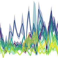
Rapid climate change has been driving changes in Arctic vegetation in recent decades, with increased shrub dominance in many tundra ecosystems. Dendroecological observations of tundra shrubs can provide insight into current and past growth and recruitment patterns, both key components for understanding and predicting ongoing and future Arctic shrub dynamics. However, generalizing these dynamics is challenging as they are highly scale-dependent and vary among sites, species, and individuals. Here, we provide a perspective on how some of these challenges can be overcome. Based on a targeted literature search of dendrochronological studies from 2005 to 2022, we highlight five research gaps that currently limit dendro-based studies from revealing cross-scale ecological insight into shrub dynamics across the Arctic biome. We further discuss the related research priorities, suggesting that future studies could consider: 1) increasing focus on intra- and interspecific variation, 2) including demographic responses other than radial growth, 3) incorporating drivers, in addition to warming, at different spatial and temporal scales, 4) implementing systematic and unbiased sampling approaches, and 5) investigating the cellular mechanisms behind the observed responses. Focusing on these aspects in dendroecological studies could improve the value of the field for addressing cross-scale and plant community-framed ecological questions. We outline how this could be facilitated through the integration of community-based dendroecology and dendroanatomy with remote sensing approaches. Integrating new technologies and a more multidisciplinary approach in dendroecological research could provide key opportunities to close important knowledge gaps in our understanding of scale-dependencies, as well as intra- and inter-specific variation, in vegetation community dynamics across the Arctic tundra.
|
||||
 |
28. Influences of summer warming and nutrient availability on Salix glauca L. growth in Greenland along an ice to sea gradient Prendin AL, Normand S, Carrer M, Pedersen NB, Matthiesen H, Westergaard-Nielsen A, Elberling B, Treier UA & Hollesen J |
Read Abstract |
||
|
The combined effects of climate change and nutrient availability on Arctic vegetation growth are poorly understood. Archaeological sites in the Arctic could represent unique nutrient hotspots for studying the long-term effect of nutrient enrichment. In this study, we analysed a time-series of ring widths of Salix glauca L. collected at nine archaeological sites and in their natural surroundings along a climate gradient in the Nuuk fjord region, Southwest Greenland, stretching from the edge of the Greenlandic Ice Sheet in the east to the open sea in the west. We assessed the temperature-growth relationship for the last four decades distinguishing between soils with past anthropogenic nutrient enrichment (PANE) and without (controls). Along the East–West gradient, the inner fjord sites showed a stronger temperature signal compared to the outermost ones. Individuals growing in PANE soils had wider ring widths than individuals growing in the control soils and a stronger climate-growth relation, especially in the inner fjord sites. Thereby, the individuals growing on the archaeological sites seem to have benefited more from the climate warming in recent decades. Our results suggest that higher nutrient availability due to past human activities plays a role in Arctic vegetation growth and should be considered when assessing both the future impact of plants on archaeological sites and the general greening in landscapes with contrasting nutrient availability. |
||||
 |
27. EcoDes-DK15: High-resolution ecological descriptors of vegetation and terrain derived from Denmark's national airborne laser scanning data set Assmann JJ, Moeslund JE, Treier UA & Normand S |
Read Abstract |
||
|
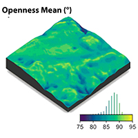
Biodiversity studies could strongly benefit from three-dimensional data on ecosystem structure derived from contemporary remote sensing technologies, such as Light Detection and Ranging (LiDAR). Despite the increasing availability of such data at regional and national scales, the average ecologist has been limited in accessing them due to high requirements on computing power and remote-sensing knowledge. We processed Denmark's publicly available national Airborne Laser Scanning (ALS) data set acquired in 2014/15 together with the accompanying elevation model to compute 70 rasterized descriptors of interest for ecological studies. With a grain size of 10 m, these data products provide a snapshot of high-resolution measures including vegetation height, structure and density, as well as topographic descriptors including elevation, aspect, slope and wetness across more than forty thousand square kilometres covering almost all of Denmark's terrestrial surface. The resulting data set is comparatively small (~ 87 GB, compressed 16.4 GB) and the raster data can be readily integrated into analytical workflows in software familiar to many ecologists (GIS software, R, Python). Source code and documentation for the processing workflow are openly available via a code repository, allowing for transfer to other ALS data sets, as well as modification or re-calculation of future instances of Denmark’s national ALS data set. We hope that our high-resolution ecological vegetation and terrain descriptors (EcoDes-DK15) will serve as an inspiration for the publication of further such data sets covering other countries and regions and that our rasterized data set will provide a baseline of the ecosystem structure for current and future studies of biodiversity, within Denmark and beyond. The full data set is available on Zenodo: https://doi.org/10.5281/zenodo.4756556 (Assmann et al., 2021) A 5 MB teaser subset is also available: https://doi.org/10.5281/zenodo.6035188 (Assmann et al., 2022a) Keywords: LiDAR • Denmark • ecology • OPALS • open data • open code • Python • DTM • ecological descriptors |
||||
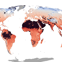 |
26. Global maps of soil temperature Lembrechts JJ, van den Hoogen J, et al. |
Read Abstract |
||
|
Research in global change ecology relies heavily on global climatic grids derived from estimates of air temperature in open areas at around 2 m above the ground. These climatic grids do not reflect conditions below vegetation canopies and near the ground surface, where critical ecosystem functions occur and most terrestrial species reside. Here, we provide global maps of soil temperature and bioclimatic variables at a 1-km² resolution for 0–5 and 5–15 cm soil depth. These maps were created by calculating the difference (i.e., offset) between in-situ soil temperature measurements, based on time series from over 1200 1-km² pixels (summarized from 8500 unique temperature sensors) across all the world’s major terrestrial biomes, and coarse-grained air temperature estimates from ERA5-Land (an atmospheric reanalysis by the European Centre for Medium-Range Weather Forecasts). We show that mean annual soil temperature differs markedly from the corresponding gridded air temperature, by up to 10°C (mean = 3.0 ± 2.1°C), with substantial variation across biomes and seasons. Over the year, soils in cold and/or dry biomes are substantially warmer (+3.6 ± 2.3°C) than gridded air temperature, whereas soils in warm and humid environments are on average slightly cooler (-0.7 ± 2.3°C). The observed substantial and biome-specific offsets emphasize that the projected impacts of climate and climate change on near-surface biodiversity and ecosystem functioning are inaccurately assessed when air rather than soil temperature is used, especially in cold environments. The global soil-related bioclimatic variables provided here are an important step forward for any application in ecology and related disciplines. Nevertheless, we highlight the need to fill remaining geographic gaps by collecting more in-situ measurements of microclimate conditions to further enhance the spatiotemporal resolution of global soil temperature products for ecological applications Keywords: bioclimatic variables • global maps • microclimate • near-surface temperatures • soil-dwelling organisms • soil temperature • temperature offset • weather stations |
||||
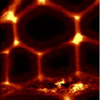 |
25. Chemical signature of Eurois occulta L. outbreaks in the xylem cell wall of Salix glauca L. in Greenland Prendin AL, Carrer M, Pedersen NB, Normand S, Hollesen J, Treier UA, Pividori M & Thygesen LG |
Read Abstract |
||
|
Insect defoliations are a major natural disturbance in high-latitude ecosystems and are expected to increase in frequency and severity due to current climatic change. Defoliations cause severe reductions in biomass and carbon investments that affect the functioning and productivity of tundra ecosystems. Here we combined dendro-anatomical analysis with chemical imaging to investigate the direct and lagged effects of insect outbreaks on carbon investment. We analysed the content of lignin vs. holocellulose, i.e. unspecified carbohydrates in xylem samples of Salix glauca L. collected at Iffiartarfik, Nuuk fjord, Greenland, featuring two outbreak events of the moth Eurois occulta L. Cross sections of the growth rings corresponding to both outbreaks ±3 years were analysed using confocal Raman imaging to identify possible chemical signatures related to insect defoliation on fibres, vessels, and ray parenchyma cells and to get insight into species-specific defence responses. Outbreak years with narrower rings and thinner fibre cell walls are accompanied by a change in the content of cell-wall polymers but not their underlying chemistry. Indeed, during the outbreaks the ratio between lignin and carbohydrates significantly increased in fibre but not vessel cell walls due to an increase in lignin content coupled with a reduced content of carbohydrates. Parenchyma cell walls and cell corners did not show any significant changes in the cell-wall biopolymer content. The selective adjustment of the cell-wall composition of fibres but not vessels under stressful conditions could be related to the plants priority to maintain an efficient hydraulic system rather than mechanical support. However, the higher lignin content of fibre cell walls formed during the outbreak events could increase mechanical stiffness to the thin walls by optimizing the available resources. Chemical analysis of xylem traits with Raman imaging is a promising approach to highlight hidden effects of defoliation otherwise overlooked with classical dendroecological methods.
Keywords: chemical imaging • Raman micro-spectroscopy • insect outbreaks • lignocellulose • wood anatomy • Greenland |
||||
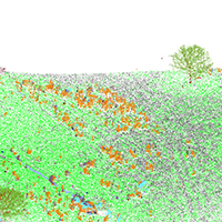 |
24. Detecting shrub encroachment in seminatural grasslands using UAS LiDAR Madsen B, Treier UA, Zlinszky A, Lucieer A & Normand S |
Read Abstract |
||
|
1. Shrub encroachment in seminatural grasslands threatens local biodiversity unless management is applied to reduce shrub density. Dense vegetation of Cytisus scoparius homogenizes the landscape negatively affecting local plant diversity. Detecting structural change (e.g., biomass) is essential for assessing negative impacts of encroachment. Hence, exploring new monitoring tools to achieve this task is important for effectively capturing change and evaluating management activities. 2. This study combines traditional field‐based measurements with novel Light Detection and Ranging (LiDAR) observations from an Unmanned Aircraft System (UAS). We investigate the accuracy of mapping C. scoparius in three dimensions (3D) and of structural change metrics (i.e., biomass) derived from ultrahigh‐density point cloud data (>1,000 pts/m2). Presence–absence of 12 shrub or tree genera was recorded across a 6.7 ha seminatural grassland area in Denmark. Furthermore, 10 individuals of C. scoparius were harvested for biomass measurements. With a UAS LiDAR system, we collected ultrahigh‐density spatial data across the area in October 2017 (leaf‐on) and April 2018 (leaf‐off). We utilized a 3D point‐based classification to distinguish shrub genera based on their structural appearance (i.e., density, light penetration, and surface roughness). 3. From the identified C. scoparius individuals, we related different volume metrics (mean, max, and range) to measured biomass and quantified spatial variation in biomass change from 2017 to 2018. We obtained overall classification accuracies above 86% from point clouds of both seasons. Maximum volume explained 77.4% of the variation in biomass. 4. The spatial patterns revealed landscape‐scale variation in biomass change between autumn 2017 and spring 2018, with a notable decrease in some areas. Further studies are needed to disentangle the causes of the observed decrease, for example, recent winter grazing and/or frost events. 5. Synthesis and applications: We present a workflow for processing ultrahigh‐density spatial data obtained from a UAS LiDAR system to detect change in C. scoparius. We demonstrate that UAS LiDAR is a promising tool to map and monitor grassland shrub dynamics at the landscape scale with the accuracy needed for effective nature management. It is a new tool for standardized and nonbiased evaluation of management activities initiated to prevent shrub encroachment.
Keywords: biomass • grassland dynamics • remote sensing • scotch broom • shrub encroachment • UAS LiDAR |
||||
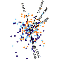 |
23. Global plant trait relationships extend to the climatic extremes of the tundra biome Thomas HJD, Bjorkman AD, Myers-Smith IH, Elmendorf SC, Kattge J, Diaz S, Vellend M et al. |
Read Abstract |
||
|
The majority of variation in six traits critical to the growth, survival and reproduction of plant species is thought to be organised along just two dimensions, corresponding to strategies of plant size and resource acquisition. However, it is unknown whether global plant trait relationships extend to climatic extremes, and if these interspecific relationships are confounded by trait variation within species. We test whether trait relationships extend to the cold extremes of life on Earth using the largest database of tundra plant traits yet compiled. We show that tundra plants demonstrate remarkably similar resource economic traits, but not size traits, compared to global distributions, and exhibit the same two dimensions of trait variation. Three quarters of trait variation occurs among species, mirroring global estimates of interspecific trait variation. Plant trait relationships are thus generalizable to the edge of global trait-space, informing prediction of plant community change in a warming world.
Keywords: Tundra biome • climate • plant traits • TRY • alpine • arctic • Tundra Trait Team (TTT) |
||||
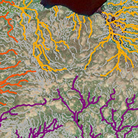 |
22. Estimating meltwater retention and associated nitrate redistribution during snowmelt in an Arctic tundra landscape Westergaard-Nielsen A, Balstrøm T, Treier UA, Normand S & Elberling B |
Read Abstract |
||
|
Nitrogen availability in Arctic ecosystems is a key driver for biological activity, including plant, growth and thereby directly linked to the greening of the Arctic. Here, we model the redistribution of meltwater following spring snowmelt as well as the accumulation of meltwater and dissolved nitrate at landscape scale. By combining snow mapping with unmanned aerial systems, snow chemistry, and hydrological modelling, we argue that the majority of nitrate in the snowpack is flushed out of the landscape due to the limited storage capacity of meltwater in the early growing season frozen soil. We illustrate how landscape micro-topography is a crucial parameter to quantify storage capacity of meltwater at landscape scale and thereby the associated pool of soluble compounds such as nitrate. This pool will be available for plants and may be important for plant diversity and growth rates in the wettest part of the landscape. This study illustrates that the evenly distributed nitrate input during the Arctic winter may be redistributed during the initial snowmelt and lead to marked differences in biologically available nitrate at the onset of the growing season, but also that the majority of deposited nitrate in snow is lost from the terrestrial to the aquatic environment during snowmelt.
Keywords: Arctic tundra • Greenland • UAS • drones • snow • flow model • meltwater |
||||
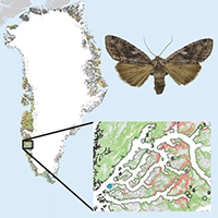 |
21. Immediate and carry-over effects of insect outbreaks on vegetation growth in West Greenland assessed from cells to satellite Prendin AL, Carrer M, Karami M, Hollesen J, Pedersen NB, Pividori M, Treier UA, Westergaard-Nielsen A, Elberling B & Normand S |
Read Abstract |
||
|
Aim
|
||||
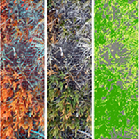 |
20. Transferability and the effect of colour calibration during multi-image classification of Arctic vegetation change Kolyaie S, Treier UA, Watmough GR, Madsen B, Bøcher PK, Psomas A, Bösch R & Normand S |
Read Abstract |
||
|
Mapping changes in vegetation cover is essential for understanding the consequences of climate change on Arctic ecosystems. Classification of ultra-high spatial-resolution (UHR, <1cm) imagery can provide estimates of vegetation cover across space and time. The challenge of this approach is to assure comparability of classification across many images taken at different illumination conditions and locations. With warming, vegetation at higher elevation is expected to resemble current vegetation at lower elevation. To investigate the value of classification of UHR imagery for monitoring vegetation change, we collected visible and near infrared images from 108 plots with handheld cameras along an altitudinal gradient in Greenland and examined the classification accuracy of shrub cover on independent images (i.e. classification transferability). We implemented several models to examine if colour calibration improves transferability based on an in-image calibration target. The classifier was trained on different number of images to find the minimum training subset size. With a training set of ~20% of the images the overall accuracy levelled off at about 81% and 68% on the non-calibrated training and validation images, respectively. Colour calibration improved the accuracy on training images (1-4%) while it only improved the classifier transferability significantly for training sets <20%. Linear calibration only based on the target's grey series improved transferability most. Reasonable transferability of Arctic shrub cover classification can be obtained based only on spectral data and about 20% of all images. This is promising for vegetation monitoring through multi-image classification of UHR imagery acquired with hand-held cameras or Unmanned Aerial Systems.
|
||||
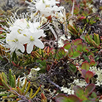 |
19. Traditional plant functional groups explain variation in economic but not size-related traits across the tundra biome Thomas HJD, Myers-Smith IH, Bjorkman AD, Elmendorf SC et al. |
Read Abstract |
||
|
Aim Plant functional groups are widely used in community ecology and earth system modelling to describe trait variation within and across plant communities. However, this approach rests on the assumption that functional groups explain a large proportion of trait variation among species. We test whether four commonly used plant functional groups represent variation in six ecologically important plant traits.
Location Tundra biome.
Time period Data collected between 1964 and 2016.
Major taxa studied 295 tundra vascular plant species.
Methods We compiled a database of six plant traits (plant height, leaf area, specific leaf area, leaf dry matter content, leaf nitrogen, seed mass) for tundra species. We examined the variation in species-level trait expression explained by four traditional functional groups (evergreen shrubs, deciduous shrubs, graminoids, forbs), and whether variation explained was dependent upon the traits included in analysis. We further compared the explanatory power and species composition of functional groups to alternative classifications generated using post hoc clustering of species-level traits.
Results Traditional functional groups explained significant differences in trait expression, particularly amongst traits associated with resource economics, which were consistent across sites and at the biome scale. However, functional groups explained 19% of overall trait variation and poorly represented differences in traits associated with plant size. Post hoc classification of species did not correspond well with traditional functional groups, and explained twice as much variation in species-level trait expression.
Main conclusions Traditional functional groups only coarsely represent variation in well-measured traits within tundra plant communities, and better explain resource economic traits than size-related traits. We recommend caution when using functional group approaches to predict tundra ecosystem change, or ecosystem functions relating to plant size, such as albedo or carbon storage. We argue that alternative classifications or direct use of specific plant traits could provide new insight into ecological prediction and modelling.
Keywords: cluster analysis • community composition • ecosystem function • plant functional groups • plant functional types • plant traits • tundra biome • vegetation change |
||||
 |
18. A phenology-based approach to the classification of Arctic tundra ecosystems in Greenland Karami M, Westergaard-Nielsen A, Normand S, Treier UA, Elberling B & Hansen BU |
Read Abstract |
||
|
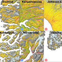
The disproportionate warming in the Arctic and the resulting adverse ecosystem changes underline the importance of continued monitoring of these ecosystems. Land-cover classification maps of the Arctic regions are essential for monitoring and change detection purposes, as well as upscaling of various ecosystem processes. However, large-scale land cover maps of the Arctic regions are often too coarse to properly capture the heterogeneity of these landscapes. In this study, we bridge this gap through incorporating multi temporal Landsat-8 OLI data in a large-scale land cover classification, and subsequently produce a tundra classification map for the entire Greenland. An algorithm is developed that allows for the extraction of vegetation phenology from single-year time series of 4169 OLI scenes at 30 m resolution despite the low revisit frequency of the satellite and persistent cloud cover. The phenological metrics, satellite-derived wetness, and terrain information are then used to separate land surface classes using a random forest classifier. The optimal algorithm parameters and input layers are identified, ultimately yielding a cross-validation accuracy of 89.25% across the studied area. Finally, we have conducted a comprehensive analysis on the resulting land-cover map and for the first time presented the geographical distribution, latitudinal gradients, and climate linkages of the various tundra vegetation classes across the ice-free part of Greenland. With a resolution of 30 m and Greenland-wide spatial coverage, the produced land-cover map can support various applications at scales ranging from the landscape to regional level. Keywords: Tundra classification • Vegetation phenology • Random forest • Arctic vegetation • Greenland • Landsat time series |
||||
 |
17. Tundra Trait Team: A database of plant traits spanning the tundra biome Bjorkman AD, Myers-Smith IH, Elmendorf SC, Normand S, Thomas HJD et al. |
Read Abstract |
||
|
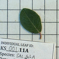
Motivation The Tundra Trait Team (TTT) database includes field-based measurements of key traits related to plant form and function at multiple sites across the tundra biome. This dataset can be used to address theoretical questions about plant strategy and trade-offs, trait–environment relationships and environmental filtering, and trait variation across spatial scales, to validate satellite data, and to inform Earth system model parameters. Main types of variable contained The database contains 91,970 measurements of 18 plant traits. The most frequently measured traits (> 1,000 observations each) include plant height, leaf area, specific leaf area, leaf fresh and dry mass, leaf dry matter content, leaf nitrogen, carbon and phosphorus content, leaf C:N and N:P, seed mass, and stem specific density. Spatial location and grain Measurements were collected in tundra habitats in both the Northern and Southern Hemispheres, including Arctic sites in Alaska, Canada, Greenland, Fennoscandia and Siberia, alpine sites in the European Alps, Colorado Rockies, Caucasus, Ural Mountains, Pyrenees, Australian Alps, and Central Otago Mountains (New Zealand), and sub-Antarctic Marion Island. More than 99% of observations are georeferenced. Time period and grain All data were collected between 1964 and 2018. A small number of sites have repeated trait measurements at two or more time periods. Major taxa and level of measurement Trait measurements were made on 978 terrestrial vascular plant species growing in tundra habitats. Most observations are on individuals (86%), while the remainder represent plot or site means or maximums per species. Software format csv file and GitHub repository with data cleaning scripts in R; contribution to TRY plant trait database (www.try-db.org) to be included in the next version release.
Keywords: Arctic • tundra • plant functional traits • database • TRY |
||||
 |
16. Plant functional trait change across a warming tundra biome Bjorkman AD, Myers-Smith IH, Elmendorf SC, Normand S, Rüger N et al. |
Read Abstract |
||
|
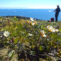
The tundra is warming more rapidly than any other biome on Earth, and the potential ramifications are far-reaching because of global feedback effects between vegetation and climate. A better understanding of how environmental factors shape plant structure and function is crucial for predicting the consequences of environmental change for ecosystem functioning. Here we explore the biome-wide relationships between temperature, moisture and seven key plant functional traits both across space and over three decades of warming at 117 tundra locations. Spatial temperature–trait relationships were generally strong but soil moisture had a marked influence on the strength and direction of these relationships, highlighting the potentially important influence of changes in water availability on future trait shifts in tundra plant communities. Community height increased with warming across all sites over the past three decades, but other traits lagged far behind predicted rates of change. Our findings highlight the challenge of using space-for-time substitution to predict the functional consequences of future warming and suggest that functions that are tied closely to plant height will experience the most rapid change. They also reveal the strength with which environmental factors shape biotic communities at the coldest extremes of the planet and will help to improve projections of functional changes in tundra ecosystems with climate warming.
Keywords: Arctic • global warming • tundra • plant functional traits • plant community |
||||
 |
15. Legacies of historical human activities in arctic woody plant dynamics Normand S*, Høye TT*, Forbes BC, Bowden JJ, Davies AL, Odgaard BV, Riede F, Svenning JC, |
Read Abstract |
||
|
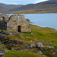
Recent changes in Arctic vegetation might not be driven by climate change alone. Legacies of human activities have received little attention as a contributing factor. We examine the degree to which traditional human activities (hunting, herding, fire, wood extraction, and agriculture) have had lasting effects on arctic woody plant communities, and therefore might continue to affect biome-wide responses to climate change. Evidence suggests that legacies are likely to be evident across meters to hundreds of kilometres and for decades, centuries, and millennia. The evidence, however, is sparse and we highlight that this could be changed with a circum-arctic collaboratory consisting of a network of interdisciplinary field sites, standardised protocols, participatory research, and new approaches. We suggest that human activities should be brought into consideration with respect to understanding the role of human legacies for Arctic vegetation dynamics in general and for variation in woody plant responses to climate change specifically.
Keywords: Arctic • collaboratory • Greenland • human perturbation • shrub community |
||||
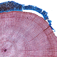 |
14. Xylem anatomical trait variability provides insight on the climate-growth relationship of Betula nana in western Greenland Nielsen SS, von Arx G, Damgaard CF, Abermann J, Buchwal A, Büntgen U, Treier UA, Barfod AS & Normand S |
Read Abstract |
||
|
Climate change has been reported to affect shrub growth positively at several sites at high northern latitudes, including several arctic environments. The observed growth rates are, however, not uniform in space and time, and the mechanistic drivers of these patterns remain poorly understood. Here we investigated spatio-temporal interactions between climatic conditions, xylem anatomical traits, and annual growth of 21 Betula nana L. individuals from western Greenland for the period 2001–2011. Structural equation modeling showed that summer precipitation and winter temperature are affecting annual growth positively. Furthermore, vessel lumen area and vessel grouping, which are related to water conductivity and hydraulic connectivity of the xylem, respectively, positively influenced annual growth. To optimize growth B. nana was thus able to adjust its water transporting system. Annual variation in vessel lumen area seemed to be driven mostly by spring and summer temperatures, whereas annual variation in vessel grouping was driven by winter temperature. Linear models did not reveal a pattern in the spatial variation of xylem anatomical traits across the sampled climatic gradient. However, growth was positively correlated with local variation in insolation. Our results suggest that B. nana can adjust its hydraulic capacity to annual fluctuations in climatic conditions in order to optimize its total radial stem growth rate.
Keywords: Greenland • Quantitative Wood Anatomy• Betula nana • ROXAS • Climate Change • Structural Equation Modeling (SEM) |
||||
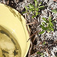 |
13. Meter scale variation in shrub dominance and soil moisture structure arctic arthropod communities Hansen RR, Hansen OLP, Bowden JJ, Treier UA, Normand S & Høye T |
Read Abstract |
||
|
The Arctic is warming at twice the rate of the rest of the world. This impacts Arctic species both directly, through increased temperatures, and indirectly, through structural changes in their habitats. Species are expected to exhibit idiosyncratic responses to structural change, which calls for detailed investigations at the species and community level. Here, we investigate how arthropod assemblages of spiders and beetles respond to variation in habitat structure at small spatial scales. We sampled transitions in shrub dominance and soil moisture between three different habitats (fen, dwarf shrub heath, and tall shrub tundra) at three different sites along a fjord gradient in southwest Greenland, using yellow pitfall cups. We identified 2,547 individuals belonging to 47 species. We used species richness estimation, indicator species analysis and latent variable modeling to examine differences in arthropod community structure in response to habitat variation at local (within site) and regional scales (between sites). We estimated species responses to the environment by fitting species-specific generalized linear models with environmental covariates. Species assemblages were segregated at the habitat and site level. Each habitat hosted significant indicator species, and species richness and diversity were significantly lower in fen habitats. Assemblage patterns were significantly linked to changes in soil moisture and vegetation height, as well as geographic location. We show that meter-scale variation among habitats affects arthropod community structure, supporting the notion that the Arctic tundra is a heterogeneous environment. To gain sufficient insight into temporal biodiversity change, we require studies of species distributions detailing species habitat preferences. Keywords: Biodiversity • Biogeography • Conservation Biology • Ecology • Entomology |
||||
 |
12. A greener Greenland? Climatic potential and long-term constraints on future expansions of trees and shrubs Normand S, Randin C, Ohlemüller R, Bay C, Høye TT, Kjær ED, Körner C, Lischke H, Maiorano L, Paulsen J, Pearman PB, Psomas A, Treier UA, Zimmermann NE & Svenning JC |
Read Abstract |
||
|
Warming-induced expansion of trees and shrubs into tundra vegetation will strongly impact Arctic ecosystems. Today, a small subset of the boreal woody flora found during certain Plio- Pleistocene warm periods inhabits Greenland. Whether the 21st century warming will induce a re-colonisation of a rich woody flora depends on the roles of climate and migration limitations in shaping species ranges. Using potential tree-line and climatic niche modelling, we project shifts in areas climatically suitable for tree growth and 56 Greenlandic, North American and European tree and shrub species from the Last Glacial Maximum through the present and into the future. In combination with observed tree plantings, our modelling highlights that a majority of the non-native species find climatically suitable conditions in certain parts of Greenland today, even in areas harbouring no native trees. Analyses of analog climates indicate that these conditions are widespread outside Greenland, thus increasing the likelihood of woody invasions. Nonetheless, we find a substantial migration lag for Greenland’s current and future woody flora. In conclusion, the projected climatic scope for future expansions is strongly limited by dispersal, soil development, and other disequilibrium dynamics, with plantings and unintentional seed dispersal by humans having potentially large impacts on spread rates. Keywords: arctic • climatic niche modelling • climate change impact • disequilibrium • postglacial re-colonisation • shrub expansion |
||||
 |
11. A set of 100 chloroplast DNA primer pairs to study population genetics and phylogeny in monocotyledons Scarcelli N, Barnaud A, Eiserhardt W, Treier UA, Seveno M, d’Anfray A, Vigouroux Y & Pintaud J-C |
Read Abstract |
||
|
Chloroplast DNA sequences are of great interest for population genetics and phylogenetic studies. However, only a small set of markers are commonly used. Most of them have been designed for amplification in a large range of Angiosperms and are located in the Large Single Copy (LSC). Here we developed a new set of 100 primer pairs optimized for amplification in Monocotyledons. Primer pairs amplify coding (exon) and non-coding regions (intron and intergenic spacer). They span the different chloroplast regions: 72 are located in the LSC, 13 in the Small Single Copy (SSC) and 15 in the Inverted Repeat region (IR). Amplification and sequencing were tested in 13 species of Monocotyledons: Dioscorea abyssinica, D. praehensilis, D. rotundata, D. dumetorum, D. bulbifera, Trichopus sempervirens (Dioscoreaceae), Phoenix canariensis, P. dactylifera, Astrocaryum scopatum, A. murumuru, Ceroxylon echinulatum (Arecaceae), Digitaria excilis and Pennisetum glaucum (Poaceae). The diversity found in Dioscorea, Digitaria and Pennisetum mainly corresponded to Single Nucleotide Polymorphism (SNP) while the diversity found in Arecaceae also comprises Variable Number Tandem Repeat (VNTR). We observed that the most variable loci (rps15-ycf1, rpl32-ccsA, ndhF-rpl32, ndhG-ndhI and ccsA) are located in the SSC. Through the analysis of the genetic structure of a wild-cultivated species complex in Dioscorea, we demonstrated that this new set of primers is of great interest for population genetics and we anticipate that it will also be useful for phylogeny and bar-coding studies.
Keywords: Chloroplast • microsatellite • minisatellite • monocotyledon • primer • Arecaceae • Dioscorea • Pennisetum • Digitaria |
||||
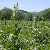 |
10. Differential effects of historical migration, glaciations and human impact on the genetic structure and diversity of the mountain pasture weed Veratrum album L. Treier UA & Müller-Schärer H |
Read Abstract |
||
|
Aim Today’s genetic population structure and diversity of species can be understood as the result of range expansion from the area of origin, past climatic oscillations and contemporary processes. We examined the relative importance of these factors in Veratrum album L., a toxic weed of mountain grasslands. Location Continental Europe. Methods Forty populations from the Asian border (Urals and Caucasus) to Portugal were studied using amplified fragment length polymorphisms (AFLPs) combined with selected plant and population measures. The data were analysed with phylogenetic, population genetic and regression methods inferring both genetic structure and diversity from geographic and ecological factors. Results Fragment frequency clines together with genetic distance clustering and principal coordinates analysis indicated an east–west direction in the genetic structure of V. album, suggesting ancient migration into Europe from a proposed Asian origin. However, the strong geographic pattern in the genetic structure, pronounced isolation by distance (R2 = 0.74) and moderate overall population differentiation (FST = 0.13) suggests high historical gene flow, possibly during glacials, and vicariance into mountainous regions during interglacials. Occurrence of V. album during the last glaciation in several areas along the periphery of the Alps and recolonization of this mountain range from both eastern and central–western areas was indicated. Genetic diversity was highest in central Europe, a pattern that did not agree with the expectations from east–west migration into Europe. Furthermore, managed habitats showed higher levels of genetic diversity compared to unmanaged habitats. Stepwise linear regression determined shoot density and soil phosphorus as the main predictors of within-population genetic diversity (R2 = 0.40). Main conclusions Our results showed that V. album retained genetic imprints of historical range expansion into Europe, although this was alleviated by the influence of climatic oscillations and contemporary processes. For example, genetic population structure was strongly affected by post-glacial vicariance while patterns of genetic diversity seemed mainly to be influenced by human land use. Our findings highlight the importance of applying a synthetic approach, testing the influence of both historical and contemporary processes on genetic structure and diversity in order to understand complex phylogeographic patterns. This may especially apply to widespread species, such as weeds. Implications of our findings for biological control are briefly discussed.
Keywords: Alpine grassland • biological control • ecological factors • false hellebore • genetic diversity • geographic origin • ice ages • Liliales • phylogeography • Quaternary |
||||
 |
9. Tree refugia and slow forest development in response to post-LGM warming in North-Eastern European Russia Normand S, Treier UA & Odgaard BV |
Read Abstract |
||
|
The paper provides a commentary on the paleoecological study by Väliranta et al. (2011, Journal of Biogeography) and a minireview on open questions such as: How far north did tree species survive the Last Glacial Maximum (LGM, ca. 21kya)? How fast did tree species spread and thus current forest structure develop during post-LGM warming? We conclude that in order to understand the spread of boreal tree and other plant species with post-LGM warming, the areas of the Russian plain and Ural need special attention.
Keywords: Last Glacial Maximum (LGM) • post-LGM warming • boreal trees • Russian plain • Reid’s paradox • fossil record • migration • dispersal |
||||
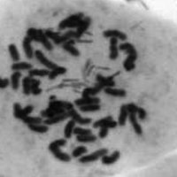 |
8. Polyploidy in phenotypic space and invasion context: a morphometric study of Centaurea stoebe s.l. Mráz P, Bourchier RS, Treier UA, Schaffner U & Müller-Schärer H |
Read Abstract |
||
|
The taxonomy of the Centaurea stoebe complex is controversial. Diploid and tetraploid plants occur in its native European range, but to date only tetraploids have been recorded from its introduced range in North America. We examined morphological differentiation of C. stoebe using multivariate and univariate approaches to clarify the taxonomic status of the known cytotypes. We measured more than 40 morphological traits on plants originating from 78 populations, grown from seed under uniform glasshouse conditions. The ploidy of almost 300 plants from 2 native and 20 introduced populations from Canada was assessed to test for the absence of diploids from North America. Finally, we explored whether postintroduction processes have resulted in phenotypic changes in introduced plants which may have contributed to the invasion success of C. stoebe. Morphometric analyses showed a clear separation of 2x and 4x plants and thus supported recognition of both cytotypes as separate taxa. Differences in the life cycle, the number of florets, the shape of capitula, and the shape of young rosette leaves were the best discriminant characters. Only minor differences were found between native and introduced tetraploids. All plants from the introduced range except for one hexaploid were found to be tetraploid. Rare diploids from Canada were identified as Centaurea diffusa or Centaurea psamogenna.
Keywords: Asteraceae • biological invasion • flow cytometry • karyology • multivariate morphometrics • polyploidy • spotted knapweed |
||||
 |
7. Evidence for a combination of pre-adapted traits and rapid adaptive change in the invasive plant Centaurea stoebe Henery ML, Bowman G, Mráz P, Treier, UA, Gex-Fabry E, Schaffner U & Müller-Schärer H Journal of Ecology, 98(4): 800-813 (2010). |
Read Abstract |
||
|
1. Introduced plants have the potential to rapidly evolve traits of ecological importance that may add to their innate potential to become invasive. During invasions, selection may favour genotypes that are already pre-adapted to conditions in the new habitat and, over time, alter the characteristics of subsequent generations.
2. Spotted knapweed (Centaurea stoebe) occurs in two predominantly spatially separated cytotypes in its native range (Europe–Western Asia), but currently only the tetraploid form has been confirmed in the introduced range (North America), where it is invasive. We used several common garden experiments to examine, across multiple populations, whether tetraploids and diploids from the native range differ in life cycle, leaf traits and reproductive capacity and if such differences would explain the predominance of tetraploids and their advance into new habitats in the introduced range. We also compared the same traits in tetraploids from the native and introduced range to determine whether any rapid adaptive changes had occurred since introduction that may have enhanced invasive potential of the species in NorthAmerica.
3. We found tetraploids had lower specific leaf area, less lamina dissection and fewer, narrower leaves than diploids. Diploids exhibited a monocarpic life cycle and produced few if any accessory rosettes. Diploids produced significantly more seeds per capitulum and had more capitula per plant than tetraploids. In contrast, the vast majority of European tetraploids continued to flower in both seasons by regenerating from multiple secondary rosettes, demonstrating a predominantly polycarpic life cycle.
4. During early growth tetraploids from NorthAmerica achieved greater biomass than both tetraploids and diploids from the native range but this did not manifest as larger above-ground biomass at maturity. In NorthAmerican tetraploids there was also evidence of a shift towards a more strictly polycarpic life cycle, less leaf dissection, greater carbon investment per leaf, and greater seed production per capitulum.
5. Synthesis. Our results suggest that the characteristics of tetraploid C. stoebe pre-adapted them (compared to diploid conspecifics) for spread and persistence of the species into habitats in North America characterized by a more continental climate. After the species’ introduction, small but potentially important shifts in tetraploid biology have occurred that may have contributed significantly to successful invasion.
Keywords: biological invasion • Centaurea stoebe • plant life cycle • plant traits • ploidy • rapid adaptive change • reproductive potential |
||||
 |
6. Importance of abiotic stress as a range-limit determinant for European plants: insights from species' responses to climatic gradients Normand S, Treier UA, Randin C, Vittoz P, Guisan A & Svenning JC Global Ecology and Biogeography, 18(4): 437-449 (2009). |
Read Abstract |
||
|
Aim: We examined whether species occurrences are primarily limited by physiological tolerance in the abiotically more stressful end of climatic gradients (the asymmetric abiotic stress limitation (AASL) hypothesis) and the geographical predictions of this hypothesis: abiotic stress mainly determines upper-latitudinal and upper-altitudinal species range limits, and the importance of abiotic stress for these range limits increases the further northwards and upwards a species occurs.
Location: Europe and the Swiss Alps.
Methods: The AASL hypothesis predicts that species have skewed responses to climatic gradients, with a steep decline towards the more stressful conditions. Based on presence–absence data we examined the shape of plant species responses (measured as probability of occurrence) along three climatic gradients across latitudes in Europe (1577 species) and altitudes in the Swiss Alps (284 species) using Huisman–Olff–Fresco, generalized linear and generalized additive models.
Results: We found that almost half of the species from Europe and one-third from the Swiss Alps showed responses consistent with the predictions of the AASL hypothesis. Cold temperatures and a short growing season seemed to determine the upper-latitudinal and upper-altitudinal range limits of up to one-third of the species, while drought provided an important constraint at lower-latitudinal range limits for up to one-fifth of the species. We found a biome-dependent influence of abiotic stress and no clear support for abiotic stress as a stronger upper range-limit determinant for species with higher latitudinal and altitudinal distributions. However, the overall influence of climate as a range-limit determinant increased with latitude.
Main conclusions: Our results support the AASL hypothesis for almost half of the studied species, and suggest that temperature-related stress controls the upper-latitudinal and upper-altitudinal range limits of a large proportion of these species, while other factors including drought stress may be important at the lower range limits.
Keywords: Biotic interactions • climate • Europe • HOF models • physiological tolerance • plant species • response curves • spatial scale • Swiss Alps |
||||
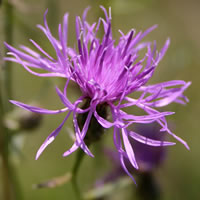 |
5. Shift in cytotype frequency and niche space in the invasive plant Centaurea maculosa Treier UA, Broennimann O, Normand S, Guisan A, Schaffner U, Steinger T & Müller-Schärer H Ecology, 90(5): 1366-1377 (2009). |
Read Abstract |
||
|
Polyploidy is often assumed to increase the spread and thus the success of alien plant species, but few empirical studies exist. We tested this hypothesis with Centaurea maculosa Lam., a species native to Europe and introduced into North America approximately 120 years ago where it became highly invasive. We analyzed the ploidy level of more than 2000 plants from 93 native and 48 invasive C. maculosa populations and found a pronounced shift in the relative frequency of diploid and tetraploid cytotypes. In Europe diploid populations occur in higher frequencies than tetraploids and only four populations had both cytotypes, while in North America diploid plants were found in only one mixed population and thus tetraploids clearly dominated. Our results showed a pronounced shift in the climatic niche between tetraploid populations in the native and introduced range toward drier climate in North America and a similar albeit smaller shift between diploids and tetraploids in the native range. The field data indicate that diploids have a predominately monocarpic life cycle, while tetraploids are often polycarpic. Additionally, the polycarpic life-form seems to be more prevalent among tetraploids in the introduced range than among tetraploids in the native range. Our study suggests that both ploidy types of C. maculosa were introduced into North America, but tetraploids became the dominant cytotype with invasion. We suggest that the invasive success of C. maculosa is partly due to preadaptation of the tetraploid cytotype in Europe to drier climate and possibly further adaptation to these conditions in the introduced range. The potential for earlier and longer seed production associated with the polycarpic life cycle constitutes an additional factor that may have led to the dominance of tetraploids over diploids in the introduced range.
Keywords: alien species • biogeography • biological invasion • Centaurea stoebe • ecological niche • ecological tolerance • flow cytometry • niche breadth • niche shift • ploidy • polyploidization • spotted knapweed |
||||
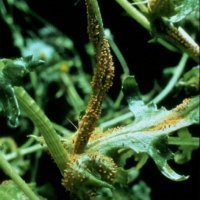 |
4. Testing the evolution of increased competitive ability (EICA) hypothesis in a novel framework Handley RJ, Steinger T, Treier UA & Müller-Schärer H Ecology, 89(2): 407-417 (2008). |
Read Abstract |
||
|
The “evolution of increased competitive ability” (EICA) hypothesis proposes that escape from natural enemies, e.g., after transcontinental introductions, alters the selection regime because costly defenses no longer enhance fitness. Such an evolutionary loss of defenses enables resources to be directed toward growth or other traits improving performance. We tested the EICA hypothesis in a novel framework in which the natural enemy is the traveler that follows its widespread host by accidental or deliberate (biocontrol) introductions. In a greenhouse experiment we used populations of Senecio vulgaris from North America, Europe, and Australia that differ in the history of exposure to the rust fungus Puccinia lagenophorae. Contrary to what is predicted by EICA, we found no evidence for increased levels of resistance to the rust fungus in plant populations with a longer history of rust exposure (Australia). Similarly, there was no evidence for reduced fecundity in these populations, although vegetative vigor, measured as secondary branching and growth rate, was lower. The maintenance of high rust resistance in populations with no (North America) or only a short history (Europe) of rust exposure is surprising given that resistance seems to incur considerable fitness costs, as indicated by the negative association between family mean resistance and fitness in the absence of disease observed for all three continents. The comparison of population differentiation in quantitative traits with estimates of differentiation in amplified fragment length polymorphic (AFLP) markers suggests that a number of fitness-related traits are under divergent selection among the studied populations. The proposed framework to test changes in the evolutionary trajectory underlying EICA can be employed in an expanded range of systems. These may include investigations on a cosmopolitan weed or crop when an antagonist is expanding its geographic range (such as our study), studies along a chronosequence of introduction time with expected increasing accumulation of natural enemies over time, or comparisons between introduced plant populations that differ in exposure time to biocontrol organisms.
Keywords: common groundsel • differences in exposure time to a plant pathogen • evolution of increased competitive ability • EICA • fitness costs • molecular markers • Puccinia lagenophorae • resistance • rust fungus • selection differentials • Senecio vulgaris |
||||
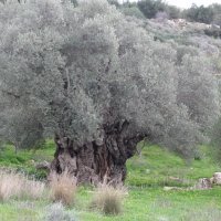 |
3. Polyploidy in the olive complex (Olea europaea L.): evidence from flow cytometry and nuclear microsatellite analyses Besnard G, García-Verdugo C, Rubio de Casas R, Treier UA, Galland N & Vargas P Annals of Botany, 101(1): 25-30 (2008). |
Read Abstract |
||
|
Background: Phylogenetic and phylogeographic investigations have been previously performed to study the evolution of the olive tree complex (Olea europaea). A particularly high genomic diversity has been found in north-west Africa. However, to date no exhaustive study has been addressed to infer putative polyploidization events and their evolutionary significance in the diversification of the olive tree and its relatives.
Methods: Representatives of the six olive subspecies were investigated using (a) flow cytometry to estimate genome content, and (b) six highly variable nuclear microsatellites to assess the presence of multiple alleles at co-dominant loci. In addition, nine individuals from a controlled cross between two individuals of O. europaea subsp. maroccana were characterized with microsatellites to check for chromosome inheritance.
Key Results: Based on flow cytometry and genetic analyses, strong evidence for polyploidy was obtained in subspp. cerasiformis (tetraploid) and maroccana (hexaploid), whereas the other subspecies appeared to be diploids. Agreement between flow cytometry and genetic analyses gives an alternative approach to chromosome counting to determine ploidy level of trees. Lastly, abnormalities in chromosomes inheritance leading to aneuploid formation were revealed using microsatellite analyses in the offspring from the controlled cross in subsp. maroccana.
Conclusions: This study constitutes the first report for multiple polyploidy in olive tree relatives. Formation of tetraploids and hexaploids may have played a major role in the diversification of the olive complex in north-west Africa. The fact that polyploidy is found in narrow endemic subspecies from Madeira (subsp. cerasiformis) and the Agadir Mountains (subsp. maroccana) suggests that polyploidization has been favoured to overcome inbreeding depression. Lastly, based on previous phylogenetic analyses, we hypothesize that subsp. cerasiformis resulted from hybridization between ancestors of subspp. guanchica and europaea.
Keywords: Flow cytometry • hexaploidy • High Atlas • Macaronesia • Olea europaea • olive • SSR • tetraploidy |
||||
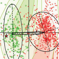 |
2. Evidence of climatic niche shift during biological invasion Broennimann O, Treier UA, Müller-Schärer H, Thuiller W, Peterson AT & Guisan A Ecology Letters, 10(8): 701-709. (2007) |
Read Abstract |
||
|
Niche-based models calibrated in the native range by relating species observations to climatic variables are commonly used to predict the potential spatial extent of species' invasion. This climate matching approach relies on the assumption that invasive species conserve their climatic niche in the invaded ranges. We test this assumption by analysing the climatic niche spaces of Spotted Knapweed in western North America and Europe. We show with robust cross-continental data that a shift of the observed climatic niche occurred between native and non-native ranges, providing the first empirical evidence that an invasive species can occupy climatically distinct niche spaces following its introduction into a new area. The models fail to predict the current invaded distribution, but correctly predict areas of introduction. Climate matching is thus a useful approach to identify areas at risk of introduction and establishment of newly or not-yet-introduced neophytes, but may not predict the full extent of invasions.
Keywords: Biological invasion • Centaurea maculosa • climate matching • niche conservatism • niche shift • niche-based models • Spotted Knapweed |
||||
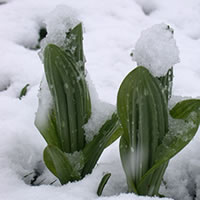 |
1. The importance of nitrogen and carbohydrate storage for plant growth of the alpine herb Veratrum album Kleijn D, Treier UA & Müller-Schärer H New Phytologist, 166(2): 565-575 (2005). |
Read Abstract |
||
|
We examined whether nitrogen (N) and carbohydrates reserves allow Veratrum album, an alpine forb, to start spring growth earlier than the neighbouring vegetation and to survive unpredictable disturbances resulting in loss of above-ground biomass.
Seasonal dynamics of plant reserves, soil N availability and vegetation growth were monitored. Veratrum album shoots were experimentally removed when carbohydrate reserves were at a seasonal minimum and the subsequent changes in biomass and reserves were compared with those in control plants.
Reserves did not give V. album a competitive advantage in spring; however, they did function as a buffer against the impact of calamities. Shoot removal resulted in significantly lower root dry weight, higher N concentration in rhizome and roots and lower starch concentrations in rhizome and roots but no plant mortality was observed.
Veratrum album used stored N reserves to supplement N uptake and establish high leaf N concentrations, which facilitated a rapid refilling of depleted carbohydrate reserves. The primary function of N reserves appears to be to allow V. album to complete the growing cycle in as short a period as possible, thus minimizing exposure to above-ground risks.
Keywords: carbohydrates • competition • defoliation • Liliaceae • nitrogen (N) • risk aversion • reserves • storage |
||||
 |
9. Nordic Crop Wild Relative (CWR) Conservation for a More Resilient Agriculture Palmé A, Lund B, Madsen B, et al. |
Read Abstract |
||
|
This report summarises the findings from a Nordic project with the long-term goal to contribute to a more sustainable and resilient agriculture by enhancing the conservation of Nordic Crop Wild Relatives (CWR) and facilitating their use. In this manner, the project improves long-term access to genetic resources that can be used to adapt agricultural plants to climate change and other future challenges. Activities include 1) species distribution modelling under different climate change scenarios, 2) inventories to determine presence and status of CWR populations in selected protected areas, 3) seed collection for long-term ex situ conservation and access from NordGen, 4) genetic diversity analysis in selected CWR, 5) Nordic cooperation and networking activities, and 6) communication and knowledge exchange. In conclusion, the project has enhanced the conservation and access to Nordic CWR, and increased the knowledge on their diversity, status, distribution, and impact due to climate change. It has strengthened the scientific foundation for conservation efforts and inspired national actions. In addition, Nordic cooperation on this topic has improved, and communication has reached a diverse set of stakeholders, including conservation professionals, policymakers, scientists, and the interested general public.
|
||||
 |
8. Crop Wild Relatives - Population inventories in Denmark 2023 Thulesen Dahl J, Madsen B, Treier UA & Normand S |
Read Abstract |
||
|
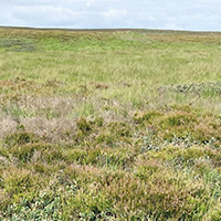
In this report we survey a selected list of Crop Wild Relative (CWR) plant species in Denmark. The survey was done at four sites, i.e., Husby, Stråsø, Mols, and Kattrup, which represent a west to east gradient across Denmark, and therefore include different environmental conditions, species pools, and genetic variation.
|
||||
 |
7. Growth, function, and distribution of shrubs in the high Arctic Normand S & Treier UA |
Read Abstract |
||
|
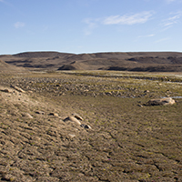
How do arctic shrubs respond to climate change? Answering this question is essential for understanding how the function of Arctic eco-systems might change in the future. Keywords: arctic • climate change • shrub expansion • drone ecology • UAS • Greenland • Villum Research Station Nord |
||||
 |
6. Arctic tundra in change / Die arktische Tundra wandelt sich Treier UA & Normand S |
Read Abstract |
||
|
Global change does not manifest itself everywhere to the same extend. In the arctic, temperatures rise faster than average which affects the occurrence and distribution of plants. Signe Normand and her team at Aarhus University, Denmark, aims at understanding the underlying processes.
Die globale Erwärmung manifestiert sich nicht überall gleich, in der Arktis wird es überdurchschnittlich wärmer. Das wirkt sich auf das Vorkommen und die Verbreitung der Pflanzen aus. Ein dänisches Forscherteam um Signe Normand von der Universität Aarhus untersucht die Zusammenhänge.
Keywords: arctic • climate change • shrub expansion • drone ecology • UAS • Greenland |
||||
 |
5. Species list of the GEO-day of species’ diversity in the Sense-canyon, june 10th 2006 / Artenliste GEO-Tag der Artenvielfalt im Sensegraben, 10. Juni 2006 Verein O.S.K.A.R. & ÖkoBüro Jacques Studer Made available online at Verein O.S.K.A.R., 2006. |
Read Abstract |
||
|
On the 9th and 10th of June 2006, 762 school children and 60 experts examined the „Sensegraben” (canyon of the Sense river, canton of Fribourg/Bern, Switzerland) within a 24 hours period (24 hour biodiversity blitz). It was possibly the largest field research campaign which took place in Switzerland. During this field campaign, 660 species where found, about 3 every minute. The present species list contains those 632 species, which have been determined unambiguously. The German GEO magazine reported on the highlights of the field campaign and the results were summarised in a newspaper article (in German).
Am 9. und 10. Juni 2006 nahmen762 Schulkinder und 60 Experten den Sensegraben innerhalb 24 Stunden unter die Lupe. Es war wohl die grösste Feldforschungsaktion, die in der Schweiz je stattgefunden hat. Während der Feldarbeiten wurden 660 Arten gefunden, ca. 3 jede Minute. Die vorliegende Artenliste enthält diejenigen 632 Arten, welche zweifelsfrei bestimmt werden konnten. Das GEO Magazin berichtete über die Höhepunkte der Feldforschungsaktion und die Resultate wurden in einem Zeitungsartikel zusammengefasst.
Keywords: field study • biodiversity • nature • species diversity • 24 hour biodiversity blitz • BioBlitz • Switzerland • Sense river |
||||
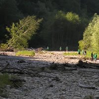 |
4. Diverse and surprising discoveries / Vielfältige und überraschende Entdeckungen Treier U Freiburger Nachrichten, SA 30.09.06: 11 (2006). Newspaper Article (in German). |
Read Abstract |
||
|
Analysis of the „GEO-day“ of species’ diversity (BioBlitz): life in the nature paradise “Sensegraben”. On the 9th and 10th of June 2006, 762 school children and 60 experts examined carefully the „Sensegraben” (canyon of the Sense river, canton of Fribourg/Bern, Switzerland); it was possibly the largest field research campaign that took place in Switzerland. At publishing time 650 species have been determined. After finishing the comprehensive determination work, 632 species have been named unambiguously. The highlights of the field campaign were summarised in the German GEO magazine.
Auswertung des Geo-Tags der Artenvielfalt: das Leben im Naturparadies Sensegraben. Am 9. und 10. Juni 2006 nahmen762 Schulkinder und 60 Experten den Sensegraben unter die Lupe; es war wohl die grösste Feldforschungsaktion, die in der Schweiz je stattgefunden hat. Zur Zeit der Veröffentlichung wurden 650 Arten bestimmt. Nach Beendigung der umfassenden Bestimmungsarbeiten konnten 632 Arten zweifelsfrei benannt werden. Das GEO Magazin berichtet über die Höhepunkte der Feldforschungsaktion.
Keywords: field study • biodiversity • nature • species diversity • 24 hour biodiversity blitz • BioBlitz • Geo magazine • Switzerland • Sense river |
||||
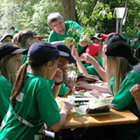 |
3. Biodiversity / Biologische Vielfalt Von Planta U & ÖkoBüro Jacques Studer Made available online at Verein O.S.K.A.R., 2006. |
Read Abstract |
||
|
The aim of the present educational material is, to sensibilise teacher and children for the significance of biodiversity and to enable insight into the immense richness of life-forms. The material should not only impart knowledge but also cause surprise and reflexion. At the same time, it should alert for the threats of biodiversity and motivate for its protection. The educational material is primarily directed at elementary schools and arranges in three parts: 1. background information, 2. supplementary information, and 3. educational aids.
Die vorliegende Unterrichtshilfe hat zum Ziel, Lehrpersonen und Kinder für die Bedeutung der biologischen Vielfalt zu sensibilisieren und ihnen einen Einblick in die unermessliche Vielfalt an Lebensformen zu ermöglichen. Sie soll nicht nur Wissen vermitteln, sondern auch zum Staunen und nachdenken anregen. Gleichzeitig soll sie auch auf die Bedrohungen der biologischen Vielfalt aufmerksam machen und zu ihrem Schutz motivieren. Diese Unterrichtshilfe richtet sich sowohl an die Primar- wie Orientierungsstufe und gliedert sich in drei Teile: 1. Hintergrundinformation, 2. Zusatzinformationen zum Vertiefen und 3. Unterrichtshilfen.
Keywords: biodiversity • nature • species diversity • threatened species • extinct species • ecosystem • floodplain |
||||
 |
2. Analysis Protocol for ABI GA 310 AFLP-runs Treier UA Made available online at University of Fribourg / Ecology & Evolution, 2004 (modified 2010). |
Read Abstract |
||
|
A lab protocol that provides a step-by-step guide to convert AFLP raw data, e.g. as generated by an ABI PRISM® 310 Genetic Analyzer, into a binary matrix by using the GelComparII™ software (version 3.5, Applied Maths). The proposed procedure allows an almost fully automated processing of ABI files.
Keywords: amplified fragment length polymorphism • automatic fragment scoring • raw data • molecular ecology • applied biosystems |
||||
 |
1. AFLP Protocol Treier UA Made available online at University of Fribourg / Ecology & Evolution, 2003 (modified 2010). |
Read Abstract |
||
|
A lab protocol that applies a multiplex PCR approach, a method that uses more than one labelled primer per PCR reaction (e.g. three). The proposed procedure increases efficiency, both concerning time and money, and was applied successfully for different species. The method was used in e.g. Handley et al. (2008) and Treier & Müller-Schärer (2011).
Keywords: amplified fragment length polymorphism • multiplex PCR • primer • molecular ecology • genetic analyzer • applied biosystems |
||||
|
My fascination for nature goes as far back as I can remember. What fascinated me was the different processes involved in growing plants rather than just learning the names given to them in our environment. I'm still very thankful to the occupational counselor who suggested high school and university rather than a gardening apprenticeship, although gardening and keeping some Bonsai trees still remain as some of my favourite hobbies alongside rock climbing and travelling. I studied Biology at the University of Fribourg, Switzerland, where I received a master's degree in Biology, specialising in Ecology and Evolution. In addition to my MSc degree in biology, I also completed courses in pedagogic and didactics to obtain an additional degree as a high school teacher (University of Fribourg/CH). Already during my studies I acquired working experience in fields outside academia, e.g. as collaborator and translator (Papiliorama/Nocturama, Switzerland) and Scientific employee (Nature and Landscape Conservation, State of Fribourg/CH; and Environmental consultants firm 'ÖkoBüro Jacques Studer', Fribourg/CH). However, science remained my primary interest, so I started a PhD project (University of Fribourg/CH, H. Müller-Schärer) and soon got involved in more exciting scientific projects and collaborations. My research carreer that started in Switzerland, guided me to the United States (University of Missouri-St. Louis, R. Ricklefs), Denmark (Aarhus University, J.C. Svenning), back to Switzerland (Swiss Federal Research Institute WSL, Christian Ginzler), and again to Denmark (Aarhus University, S. Normand). Currently I am the manager of the UAS4Ecology Lab and responsible drone operator, maintenance controller and drone pilot at the Department of Biology, Aarhus University. The UAS4Ecology Lab is involved in ecological research using drones, i.e. drone based-remote sensing, including all the necessary workflows in processing and analyzing the obtained data (visible and near infrared imagery, multispectral, thermal, hyperspectral, and LiDAR data).
|
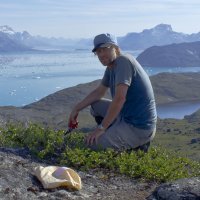
and Greenland |
|
Our quadcopter is mapping arctic vegetation, Sisimiut, Greenland, July 2015.
|
|


